

Murundi
In the heart of the Zambian Copperbelt
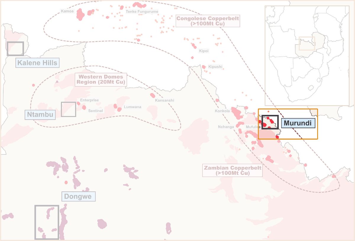
Murundi (20859-HQ-LEL, 67 km²), directly in centre of The Copperbelt, is within 3km of the prolific Mufulira mine and adjacent to Changfa Resources which is restarting the Mokambo mine after a successful drill programme.
Initial targeting work by Zamare identified the regional-scale Mokambo Fault as a potential mineralisation-controlling structure, likely responsible for the Mufulira and Mokambo mines. Regional geological maps also showed potential reducing horizons in the stratigraphy that could have caused mineralisation to precipitate from the fluids transporting them. Geochemical soil sampling across the licence in 2020 by Zamare identified anomalies associated with the fault.
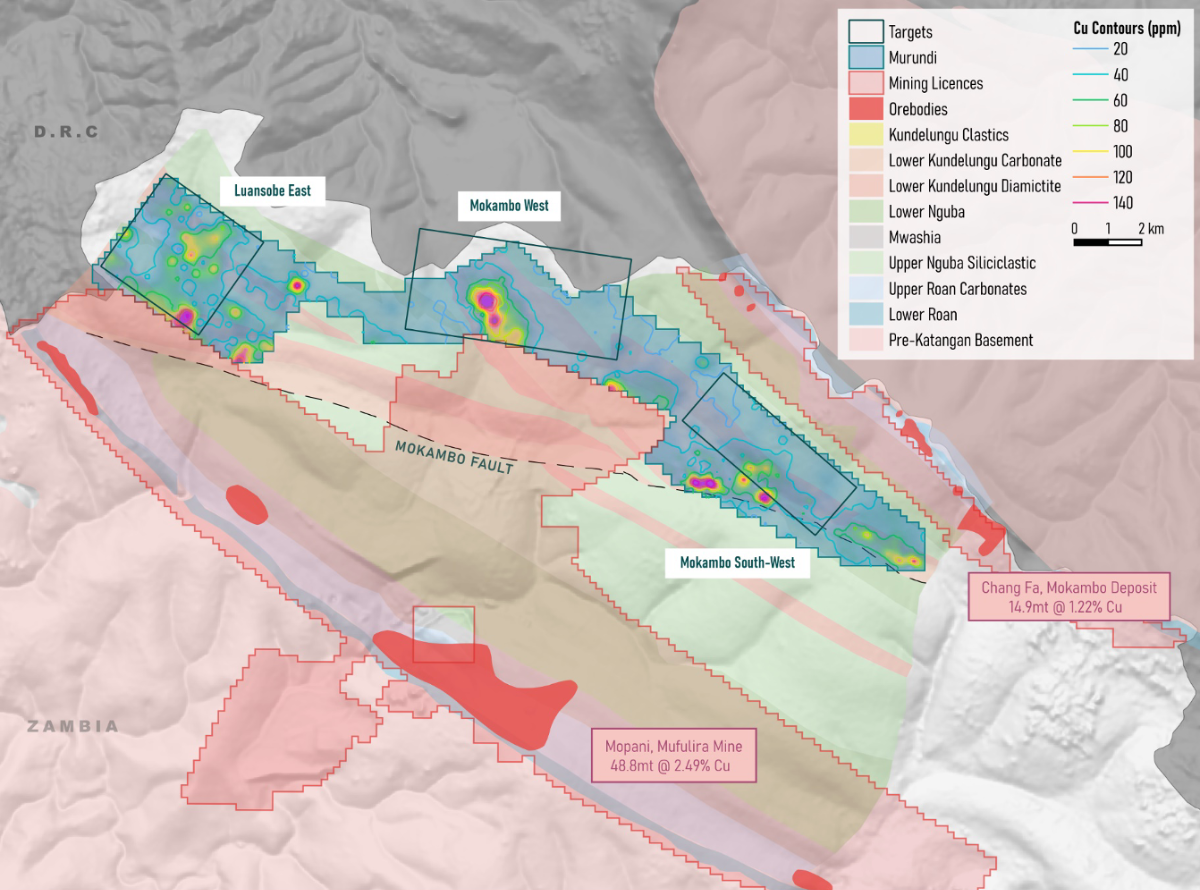
Results of airborne magnetic survey and geochemical soil sampling over the Murundi licence in 2020. (Click to zoom in)
The licence has been overlooked by previous exploration companies because it is within a stratigraphy formerly thought not to contain mineralization. Since disproven by the discovery of several deposits within the horizon, including Kamoa-Kakula, independently ranked as the Africa's largest ever, undeveloped, high-grade copper discovery.